Maps function as instruments of political power, shaping how nations allocate resources, determine voting patterns, and direct public attention. Politicians and urban planners leverage cartography to control narratives about territory, development, and civic life.
The practice dates back centuries. Colonial powers used maps to justify territorial claims. Modern legislators employ gerrymandering—manipulating district boundaries—to secure electoral advantages. Urban planners route infrastructure spending toward favored neighborhoods while neglecting others. These decisions appear neutral on paper but encode political preferences into physical space.
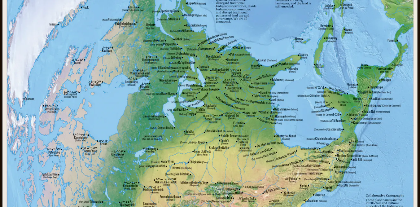
Counter-mapping represents a direct challenge to this control. Community organizations, grassroots activists, and everyday citizens create alternative maps that expose disparities invisible in official versions. These projects highlight disinvested neighborhoods, document environmental injustices, or reveal patterns of discriminatory zoning. By producing their own cartography, ordinary people contest dominant narratives and demand accountability.
Counter-mapping operates on a simple principle: visualization shapes perception. When residents map food deserts, pollution hotspots, or redlined districts, they weaponize the same tool that excluded them. The act of mapping becomes democratic participation.
Recent examples show the tactic's reach. Community groups in major cities have mapped gentrification patterns to track displacement. Environmental justice organizations chart toxic facility locations near low-income neighborhoods. Voting rights advocates create maps exposing how gerrymandered districts dilute minority representation.
The political stakes are real. Once counter-maps enter public discourse, officials face pressure to respond. Media coverage amplifies findings. Elected representatives confront visual evidence of inequities they previously ignored or defended.
Official cartography retains authority. Government maps remain the legal standard for district boundaries, property lines, and infrastructure planning. Counter-maps succeed not by replacing official versions but by creating competing narratives. They force conversations about whose interests maps serve and whose stories maps omit.
The battle over mapping reflects deeper fights about